How to Build a Storm
- Sam Nunes
- Jan 27, 2024
- 4 min read
Are you the type of person who enjoys looking out the window to experience the magnificent power of a storm? Air, water, heat and cold swirl around us every day as the world spins and these ingredients can form different types of storms that can be dangerous in different ways. Strong storms can remind us how small we are, and what can happen when enough energy builds up. So using these ingredients, how do we build a storm? Let’s get into it!

In my area of the world we are known for our Nor’easter storms. To build a nor’easter, you need lots of moisture and cold air. But cold air holds less moisture. In the Northeast United States, warm moist air is guided up north by the gulf stream ocean currents, where it comes into contact with the cold northern air from Canada. This combination at this front precipitates out all the moisture in the form of snow, and lots of it! The record in my state of Connecticut for the most snow in 24 hours was 36 inches (3ft or about 1m)! Nor’easters are not always snow though, if it is warm enough they will dump a lot of rain instead. The record in Connecticut for the most rainfall in 24 hours was around 7 inches (17.8 cm). The final characteristic of a Nor’easter is that the winds are coming from the northeast, which means that the storm is rotating counterclockwise.

Many people have experienced thunderstorms but not many people know how they are formed. Air clumps into different bundles called masses, with relatively the same temperature and humidity. Weather events are usually formed when these two air masses meet, but the type of weather event depends on the type of air masses that are meeting and the direction in which they are meeting each other. For a thunderstorm to occur, we first need to start with a warm, humid air mass. For this reason, thunderstorms are more likely in the warmer months. Warm air is less dense than cold air, so when they come into contact, the cold air slides under the warm air, driving it up into the atmosphere, where it quickly condenses into large cumulonimbus clouds, and causes relatively quick, heavy rain falls. But the air is not empty, rapidly rising and falling water in the clouds creates a positive charge at the top of the cloud and a negative charge at the bottom. As similar charges repel each other, the negatively charged ions on the ground are repelled away leaving just the positive charges. Once these charges build up enough, a current is created allowing a streak of lightning to form.

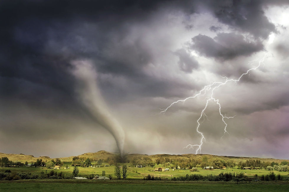
But it's not only lightning that can form in these thunderstorms. The movement of hot and cold air creates pressure differences on the ground that pull air across the landscape. Warm air is less dense than cold air, and this causes the air to move from high density to low density, which in a rapidly forming strong thunderstorm can generate rapid strong winds. But not all the air is moving equally in the same direction, and this variation can pull and rotate the air until it is moving in a cyclical motion. As I mentioned earlier, thunderstorms are characteristic for strong updrafts of air, and when the horizontal cyclone of air catches that updraft, it can be lifted up into the air, where it connects with the clouds and forms a tornado.

Hurricanes are the strongest storm on Earth and they are formed when the same conditions that form thunderstorms are able to thrive and grow into a superstorm. Rapid moist rising air near the equator grows in strength and intensity as it travels across a moist ocean. Warm low density air rising creates the eye of the storm, which pulls in cooler high density air, and this effect can reach out for thousands of miles. But Earth is not stagnant. As the Earth rotates, the ground beneath this moving air shifts, which creates a curvature in the motion of the air relative to the direction of the ground. This effect, called the Coriolis effect, causes the moving air to rotate counterclockwise in the northern hemisphere and clockwise in the southern hemisphere. So air being rapidly pulled towards the center of the storm paired with the rotation of the earth beneath this moving air creates a rotational effect that grows in intensity. When the winds reach 74 mph (119 kph), it is then classified as a hurricane. Since hurricanes are fueled by warm moist air, they tend to lose power once they come into contact with land.
Air swirls around driven by heat variations and a rotating planet. This air carries water and energy that can create dramatic demonstrations of the power of nature. Huge blankets of snow, strong discharges of electricity, and swirling columns of air that can move over 100 mph and can be a couple feet to 1000 miles wide. The same ingredients can form unique storms in different situations, and their destructive displays can be a humbling reminder of how powerful nature can be. As we trap more energy into the atmosphere, their power will adjust to the new conditions.
Sources:


Comentarios